The Great MisAdventures of David & JoEllen Laurita
Our Fulltime RV Adventures Across America With Toby The Cat
Great MisAdventures Summer 2011
Yellowstone National Park
~ Mt. Sawtell - Island Park, Idaho ~
August 13, 2011
|
Island Park describes the northern part of Fremont County from the top of the Ashton Hill to the Montana border. Within its borders is an ancient volcanic caldera that has been inactive for the last 600,000 years. It is one of the world's largest calderas about 350 square miles. It can be seen from the top of 9,875 foot Mt. Sawtell, our destination today. |
|
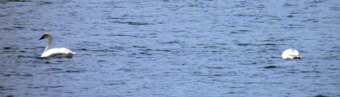
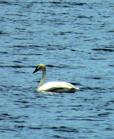
The first wildlife we see today is a first for the Great MisAdventurers, a pair of Trumpeter Swans. This swan is a rare bird throughout much of North America. Once common, it was heavily hunted in the nineteenth century. They were slaughtered in great numbers for their plumage, used to decorate ladies hats. By the 1830s, fewer than 100 birds remained. Today, it still does well in pockets of habitat scattered around the continent. One of these pockets happens to be the Yellowstone National Park region. Trumpeter swans are the largest waterfowl in North America, and easily the biggest flyers in Yellowstone. The wingspan of males (cobs) can reach seven feet. Cobs weigh between 25 and 30 pounds, while females (pens) weigh 23 to 27 pounds. The trumpeter is generally bigger and heavier than the eagle. |
|
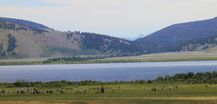
Henry's Lake Looking NE toward YNP. Lionshead RV Resort is just over the pass center right.
|
The Sawtell Peak Scenic Drive is a twelve-mile route that climbs to the top of the 9875 foot summit of Sawtell Peak. The route follows an excellent gravel road, called Sawtell Peak Road, between the town of Island Park and Sawtell Summit. From the summit, the views of the surrounding area are magnificent. From the top, the visitor gets superb views of Yellowstone National Park, the Centennial Valley in Montana and the Madison Valley in Montana. The Grand Tetons in Wyoming and the Pioneer Mountains in Montana are also visible way off in the distance. Henry's Lake and Island Park Reservior are at the base of Sawtell. Hebgen Lake is also visible across the mountains back in Montana. |
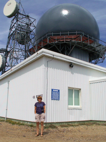 FAA Facility atop Mt. Sawtell |
|
The Sawtell Peak Road does climb quite steeply and has many sharp turns and switchbacks. The road becomes narrow at times, with a sheer drop on one side of the road. The reason there is such a well conditioned road up to the top of a lonely mountain is because the FAA operates a flight traffic control radar station on the summit. The wild flowers were in full bloom traveling this mountain road. Red, white, blue and yellow flowers gently waving to us as we travel by. God can sure plant a rich garden. We rate this MisAdventure among the top of this summers activities, if you come to the Yellowstone area, this trip is a must do! |
Our MisAdventures
- The Great Ongoing MisAdventure
- The Great Yellowstone MisAdventure
- The Great 2011 MisAdventure
- The Great 2010 MisAdventure
- The Great Tree Sales MisAdventure
- Fall 2009
- The Great Workamping MisAdventure
- Spring 2009
- The Great 2008/09 Quartzsite MisAdventure
- The Great Mexican Cruise MisAdventure
- Fall 2008
- Summer 2008
- Spring 2008
- The Great 2007/08 Quartzsite MisAdventure
- Fall 2007
- Summer 2007
- Spring 2007
- The Great 2006/07 Quartzsite MisAdventure
- October 2006
- September 2006
- The Great 2006 Northwest MisAdventure
- The Great Caribbean Cruise MisAdventure
Contact
Living Our Life
Neat Things

Lord, let us live with joy in our hearts, knowing you will grant us strength and keep us safe in our travels. Amen


Like the site?
Your contribution is appreciated!