The Great MisAdventures of David & JoEllen Laurita
Our Fulltime RV Adventures Across America With Toby The Cat
The Great Workamping MisAdventure
Delta Forest Service Campground
Williamette National Forest
Blue River, Oregon
May 10 through September 16, 2009
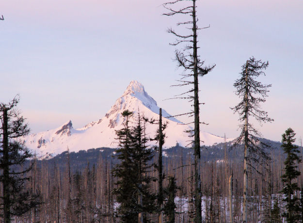
Mount Washington from Hoodoo Ski Area atop Santium Pass
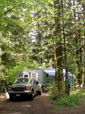 We have arrived for our Campground Attendant position with Hoodoo Recreation this summer, taking care of eight US Forest Service campgrounds. We will be located on the South Fork of the McKensie River of the Willamette National Forest. Our home this summer will be Delta Campground, Terwilliger Hot Springs will be close as well.
We will be Campground Attendants for the campgrounds along FS Road 19. We have 111 campsites and 19 mostly newer concrete vaults to keep up. We work a split shift, starting at 7:30 each morning, drive up a beautiful highway without a straightaway for more than a couple of hundred yards at a time. The uphill route is "compliance", get the money. The downhill route is more compliance and heavy cleaning. The evening route starts around 4:30, once again collecting the camp fees and light cleaning. The trash is also hauled down the mountain as needed.
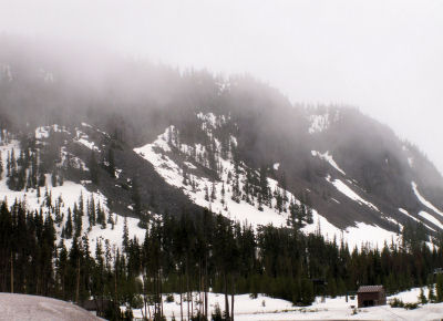
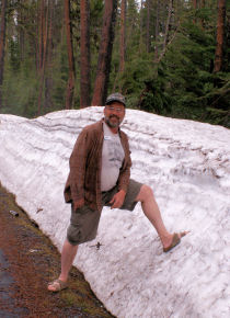
After working for a week, we went up to Hoodoo Ski Area for the orientation class to learn the proper way to do this summer job. Snow was abundant still and the temperture was chilly on top of Santium Pass. The ski area is about 30 miles from camp.
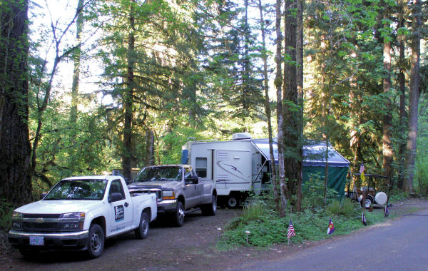
Delta is a National Forest Campground just off US Highway 126. It is located at the point where 3 rivers meet, surrounded by an old-growth forest of Douglas-fir, Western hemlock, Cedars, and various Elms. Under the tall forest can be found copious amounts of ferns, moss, lichen, Oregon Grape and other ground plants. It is a unique community of interacting parts, both seen and unseen. Wet weather, mild temperatures and the right mix of soils and nutrients combine to provide a stable and reliable host. Many side channels and streams of crystal clear water flow through this river delta. Some of the trees here are 650 years of age soaring to heights over 200 feet and weighing from 10-12 tons.
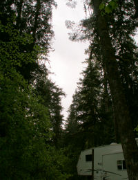
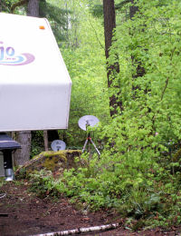 Setting up the satellite dishes proved to be a chore and a half. David knew he was in trouble without internet service from Hughesnet for the computer. The picture on the right shows the tiny slot through the tall trees. Had to set the tripod in four different spots before locking on to SatMex5, our bird in the sky. The picture on the left shows our dish in place. Never could get the DirecTV dish to line up, guess no TV this summer.
The solar system is not going to work well under this forest canopy, so we expect to run the generator when necessary.
Aufderheide Drive and Cougar Reservoir
The 452 foot Cougar Dam, the largest rock-filled dam in Oregon, was built in 1964 as flood control and is 1500 feet long. When we arrived in May, this lake was at high water mark. The FS Hydrologist told David that this body of water is a bank, and water is released when needed downstream as it is the least recreated lake in the area. The first of June it had dropped about 20' and continues to drop a foot or so each day. All of our campgrounds are accessed from this road, traveling around the reservoir, and up the South Fork of the McKenzie River. Signs warning of the presence of Bull Trout are everywhere as this is an endangered species, and is protected from being someones dinner. Aufdrheide Drive is a Scenic By Way extending in the north from Blue River to Westfir at the south end. A 62 mile highway alongside cascading streams and through lush forests. This road is designated as FS 19, and is a winding two-lane, no shoulder roller coaster ride for sure. We are lucky enough to drive this road up and back for 25 miles twice a day! Very little traffic and teriffic views.
Sahalie and Koosah Falls
Located on the McKenzie River upstream from our campground are waterfalls. Sahalie Falls, high in Chinook, is the first of three waterfalls within a short distance. Sahalie Falls are over 100 feet tall. Koosah Falls, sky in Chinook, is the second and an easy hike downstream from Sahalie.
Tamolitch Falls AKA The Blue Hole
This is the third fall in the series. The 2.3 mile hike from the parking area at Trailbridge Reservoir to the Blue Hole follows close to the McKenzie River for most of the way. About halfway to Tamolitch Pool, the river picks up steam, tumbling and churning as the trail gets a little steeper. Old lava rock appears on either side of the trail, even underfoot. The trail stays above the river, granting occasional views down to the rushing water. Then, suddenly, the rushing stops and we are looking down into clear Tamolitch Pool from atop a rock cliff. A sign calls it Tamolitch Falls, and it's easy to imagine the dramatic waterfall that would tumble down the sheer cliff at the far end of the pool if flows were high enough. Instead, the water seeps in invisibly from the lava beds creating this gorgeous Blue Hole.
Our MisAdventures
- The Great Ongoing MisAdventure
- Fall 2009
- The Great Workamping MisAdventure
- Spring 2009
- The Great 2008/09 Quartzsite MisAdventure
- The Great Mexican Cruise MisAdventure
- Fall 2008
- Summer 2008
- Spring 2008
- The Great 2007/08 Quartzsite MisAdventure
- Fall 2007
- Summer 2007
- Spring 2007
- The Great 2006/07 Quartzsite MisAdventure
- October 2006
- September 2006
- The Great 2006 Northwest MisAdventure
- The Great Caribbean Cruise MisAdventure
Contact
Living Our Life
Neat Things
Lord, let us live with joy in our hearts, knowing you will grant us strength and keep us safe in our travels. Amen

Like the site?
Your contribution is appreciated!